 Ridgeflow
Matiu/Somes Island Loop Track
Wellington · New Zealand
Distance2.8 km (1.7 mi)along the line
Climb59 m (194 ft)58 m (190 ft) down
High point48 m (157 ft)lowest 18 m (59 ft)
DOC's time40 minas DOC publishes it
Walking time48 minone way, moving, our estimate
GradeEasyDOC
Elevation profile
Map


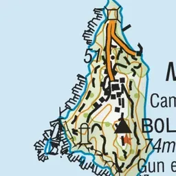



Pink: the track. Blue: campsites.
About the track
A loop track around Matiu/Somes Island offers 360 degree views of Wellington harbour - with native wildlife, remnants from the world wars, historic quarantine buildings, and a lighthouse, there is plenty to keep kids interested.
Campsites
- Matiu/somes Island Campsite (45 m)
Matiu/Somes Island Loop Track on DOC's website, for track alerts, bookings and closures.